The same report is also available in
During the end of December 2008 I was able to fulfill my dream of trekking in the Himalayas.
The same report is also available in
![]()
The trip was organized by The Chennai Trekking Club. Overall, we were 15 trekkers (a French guy, a Swiss girl, and myself were the only foreigners). Most went to New Jalpaiguri (commonly known as NJP) by train, but I preferred to fly to Bagdogra, which is the airport near Siliguri and NJP. After meeting up in NJP, which still lies in the low plain, we drove up the hills in two jeeps to Maneybhanjang, which lies near the start of Singalila National Park. This national park lies in the North-West of West Bengal, right at the borders to Nepal and to the Indian state Sikkim. And finally, on Monday, December 22, 2008, we set out on the trail, which was around 85 km total.
Maneybhanjang is a small village frequently used as base camp for treks into Singalila National Park. As such, it is not very exciting. But one quickly finds oneself within nature when leaving it.
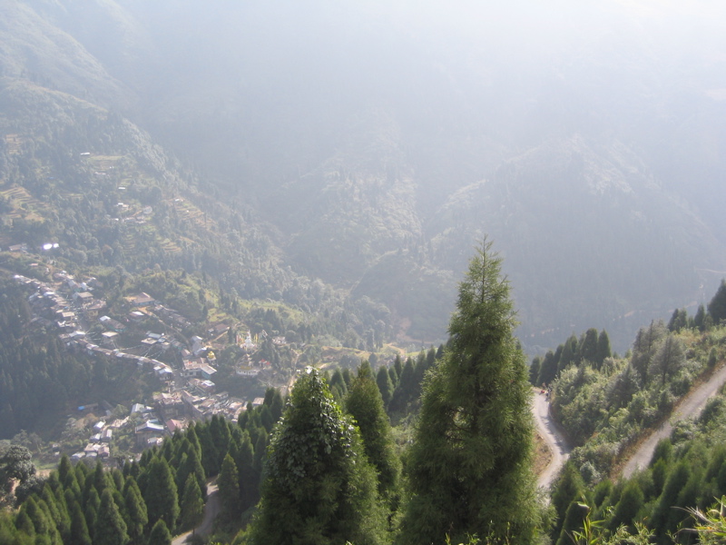
The trek starts out as a fairly steep climb until one gets to the high plateau at Chitrey Monastery. There we had our first tea break of the trek Ð a hut that was in fact lying in Nepal. There is no fence separating India and Nepal. Only occasional border stones mark it. And the fairly frequent border outposts also indicate that one finds oneself in the border region. Foreigners occasionally have to show passport and visa. So it is best to bring all relevant immigration papers (including residential permit, if available). A path suitable for 4-wheel drive jeeps goes along the border. It is maintained by the Indian Army. And more or less the entire part of the trek following the India-Nepal border followed this path.
Then we continued to Tonglu (3070 m). Actually, we were not really supposed to go to that peak. Myself and two other trekkers were a bit ahead of the rest of the group. We enjoyed the nice view, when one of the guides ran up to us and led us down a bit again to a small village (say six houses) where lunch was already waiting for us. These lunches were always filling, but of course basic.
After lunch we continued, this time more downhill until we reached Gairibas. This showed the problem of leaving too late in the morning: We ended up having to hike in the dark to reach our destination. Also, at this time of the year it often gets foggy in the afternoon. And that combined to make for some somewhat difficult hiking despite the fact that we were walking on some kind of road. On the first day it can of course easily happen that one leaves a bit too late (meaning only by 9 in the morning). After all, guides and porters have to be hired, and things have to be readied for the first time. But it did not only happen on the first day that we started a bit too late. In this aspect the organizer of the tour could have shown a firmer hand Ð even if that may not be so popular.
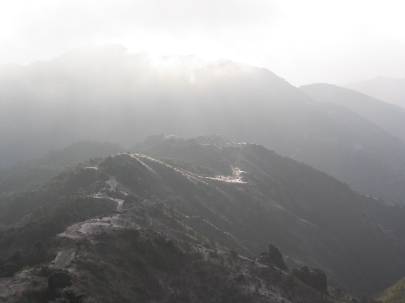
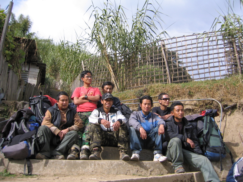
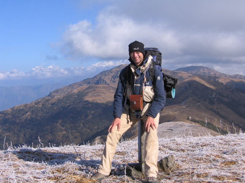
Distance-wise this was the shortest trek of the whole trip. But because we had to climb 1000 m, it was the toughest. Particularly the climb up to Sandakphu was very hard. Even though it was only around freezing point, I wore only a T-shirt on that last climb, as I sweated so much. Much of it must have been a 20 degree climb, and for sure a jeep would also have had its difficulties. It was during this climb that things became difficult for quite a few of the fellow hikers. Even an additional porter had to be hired from some hut on the way in order to take over the baggage of people (but it was a point of pride for me to carry my own stuff, which was 15 kg without water). In the end 7 guides and porters were part of the trek for 15 tourists. And what these porters lifted was impressive. It must have been anything from 20 to 25 kg per person, for we had also brought along tents and a gas stove for emergencies (though in the end it turned out that we needed neither).
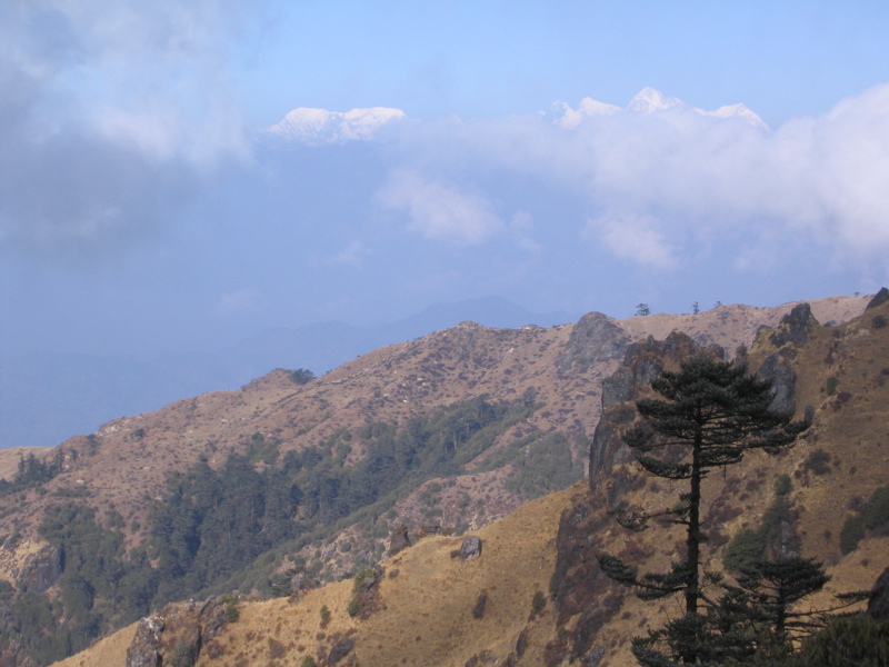
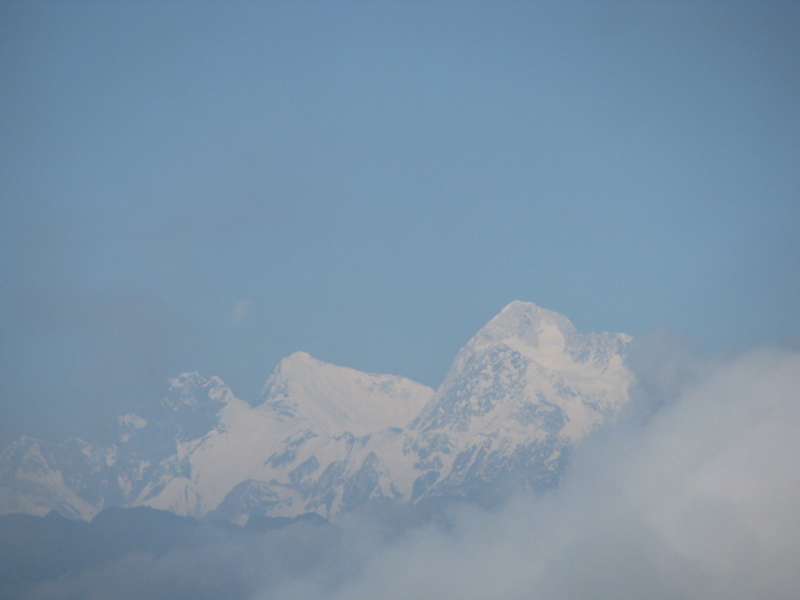
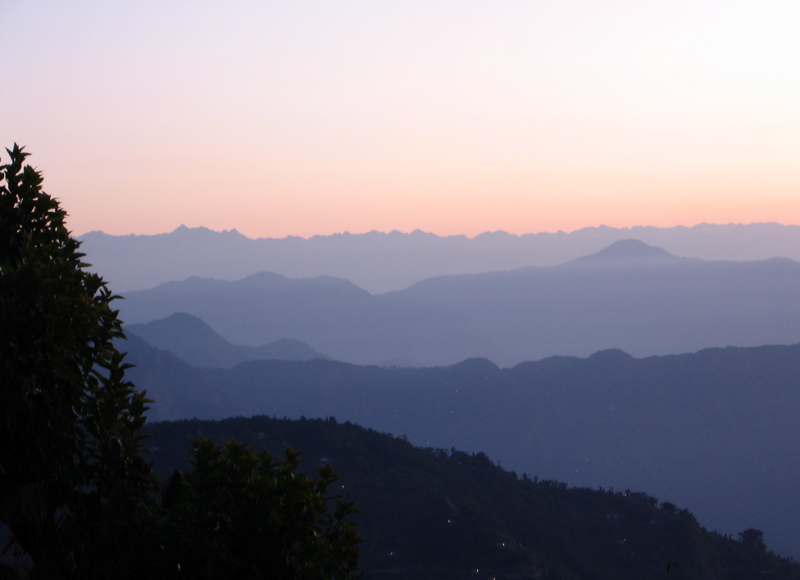
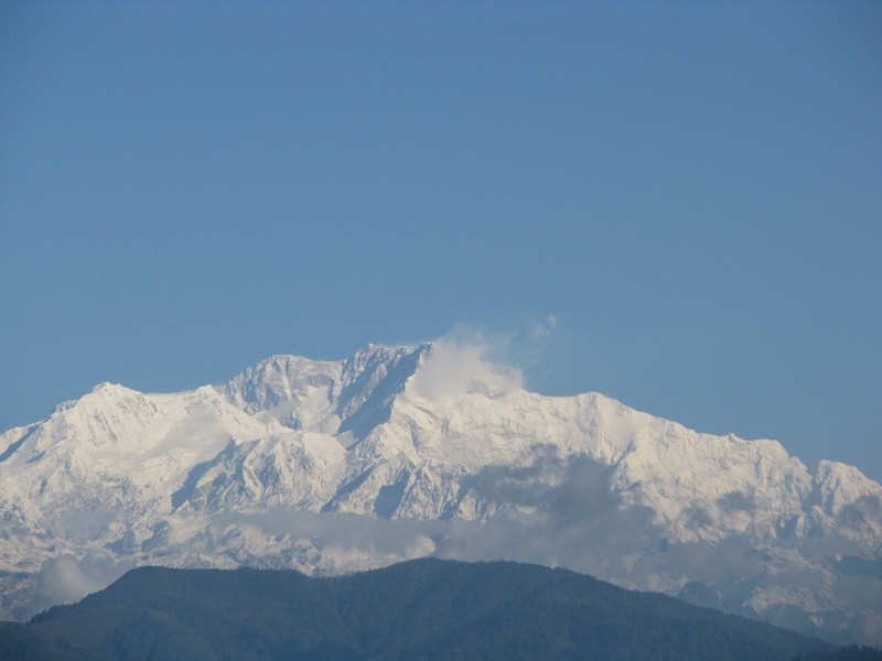
This was the first day that the weather allowed us to see the big mountains. And Mount Everest (8848 m), Lhotse (8501 m) and Makalu (8415 m) were one of the first ones we saw. We also got a glimpse of the so-called Three Sisters. That was surprising, as we had expected to see Khangchendzonga, at 8598 m the third highest peak of the world, which is much closer than Mount Everest (the latter was at a birds-fly distance of some 140 km). But in the direction of Khangchendzonga we had the most clouds and could often only see glimpses.
Lunch on that day was at Sabargram (about 3400 m) after a 14 km hike. There were no huts in between Sandakphu and Sabargram. And the original plan was to go up to Phalut after lunch. But a few of the trekkers developed some more serious problems. And it was clear that it would have been too risky for them to go up to Phalut. At this moment the guides proved their worth. They were able to come up with the alternative of spending the night at Moley, which was just another kilometer away.
Here the group split into two. Five (plus some porters) went directly to Gorkhey, which was not far from Moley and mostly downhill. The rest first went up to Phalut (3600 m) before descending to Gorkey. The organizer of the trek was one of the five. That must have been a tough decision. For sure he would have liked to go up to Phalut. Much credit goes to him for choosing the responsibility of seeing these trekkers safely off the mountain.
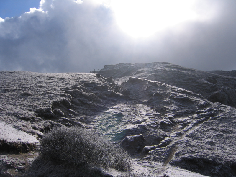
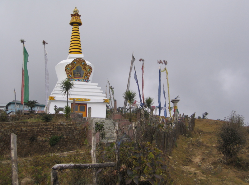
The trek from Moley to Phalut (8 km) was enchanting with the ground covered by frost and the sun frequently coming out. While we were resting for lunch at Phalut, it even started snowing Ð the first snowfall of the season. On the peak of Phalut two countries (India and Nepal) and two Indian states (West Bengal and Sikkim) touch together.
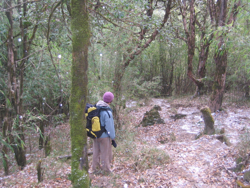
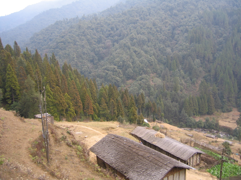
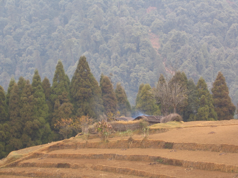
After lunch we went downhill in the most direct way and within just a bit over two hours we arrived at Gorkhey. This village is fairly typical for the remote villages of the North of West Bengal and also Sikkim. People live self-sufficient growing their own vegetables and potatoes, raising goats and cows for milk, and collecting firewood in the forest. Electricity is not available. The next primary health center (which is not a real hospital) is 21 km away in Rimbick. This autarky is at least partially the reason behind the drive to have a separate Indian state Gorkhaland in what currently is the Darjeeling district of West Bengal. People hardly feel cared for by the state government in Kolkata. For example, the power produced by a nearby hydroelectric plant mainly goes to Kolkata. Furthermore, the locals speak Nepali, while people in Kolkata speak Bengali. As so often happens in India, the separate language forms a separate identity.
This was the last trekking day. Except for one steeper climb at the beginning, it was fairly even. Lunch was at a place at 1900 m. But the climb back up to Rimbick at 2200 m was so gentle that it was hardly noticeable. And on this day we were really lucky with the weather: a thunderstorm struck right during the lunch hour. By the time we put on the backpacks, the rain had already passed.
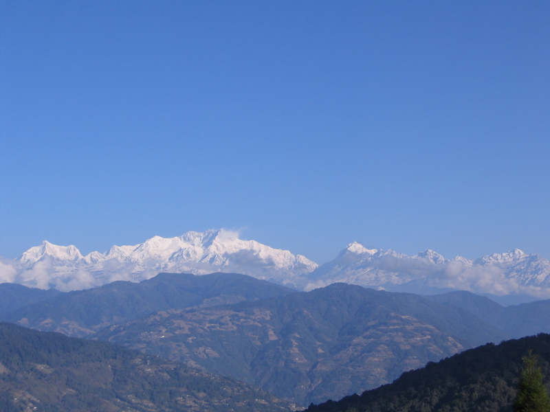
The whole time we had a nice view of the hills of Sikkim. The border river separated us from that state. But we never crossed into Sikkim. Even Indian nationals require a permit to enter Sikkim, which is not difficult to get, but which requires to go to some offices in certain cities. So on a trek one cannot simply cross over to Sikkim, and the fines are supposed to be very steep.
In Rimbick we stayed at a hotel that felt like 5-star in comparison. We were even able to use a hot shower! That was a first during this trek. For normally even a hot bucket of water for washing is not a given. After all, that requires heating the water with firewood. And firewood is far too precious to waste for something as basic as bathing-water. Which explains why washing was so unpopular during those five days of trekking. But for sure the forests did not care for a bit of Ònatural smellÓ.
On the day after finishing the trek, we drove first back to Maneybhanjang to pick up a few items. During this part of the drive, we finally got a good view of Khangchendzonga. Also, we finally got to eat momos, a Tibetan specialty (a momo is steamed dough that is wrapped around some filling; I found it a bit of a pity that during the trek we mostly ate South-Indian food instead of local food). Then we continued for Darjeeling.
Darjeeling is a bit like Ooty, meaning it is famous and overdeveloped and cannot quite live up to its reputation. During clear skies, it allows a great view of Khangchendzonga. But by the time we arrived there the clouds had already gathered around the mountain. Thus, we mostly enjoyed strolling around the city. We also discovered a nice bar near the central square.
On the next day, it was time for me to say good-bye to my fellow trekkers. As I had to catch a flight from Bagdogra on Monday, I though it prudent to already go down the hills and spend the night in Siliguri. Luckily, I got a ticket for the train from Darjeeling to Siliguri.
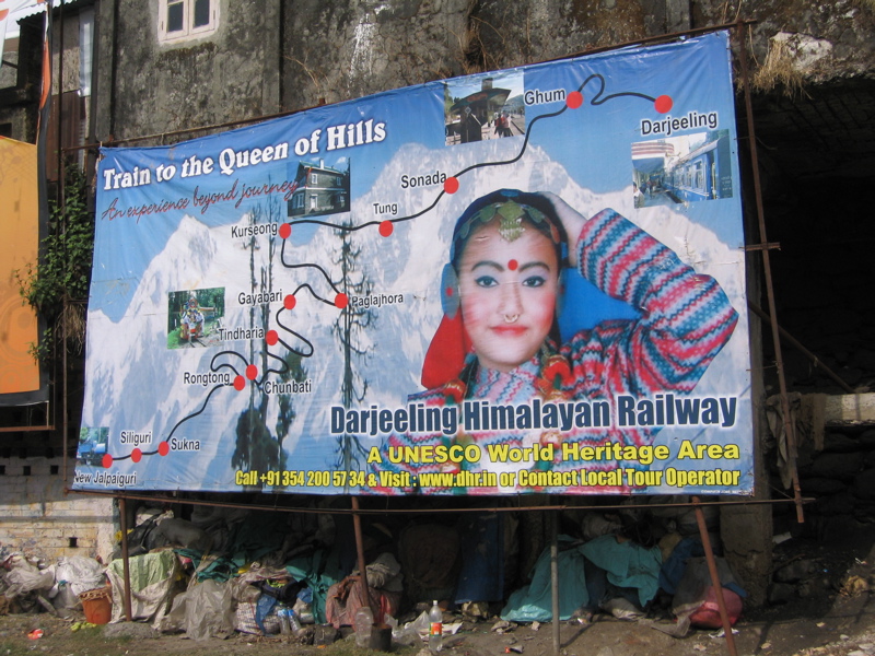
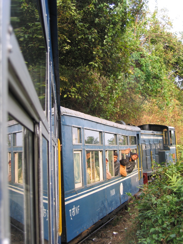
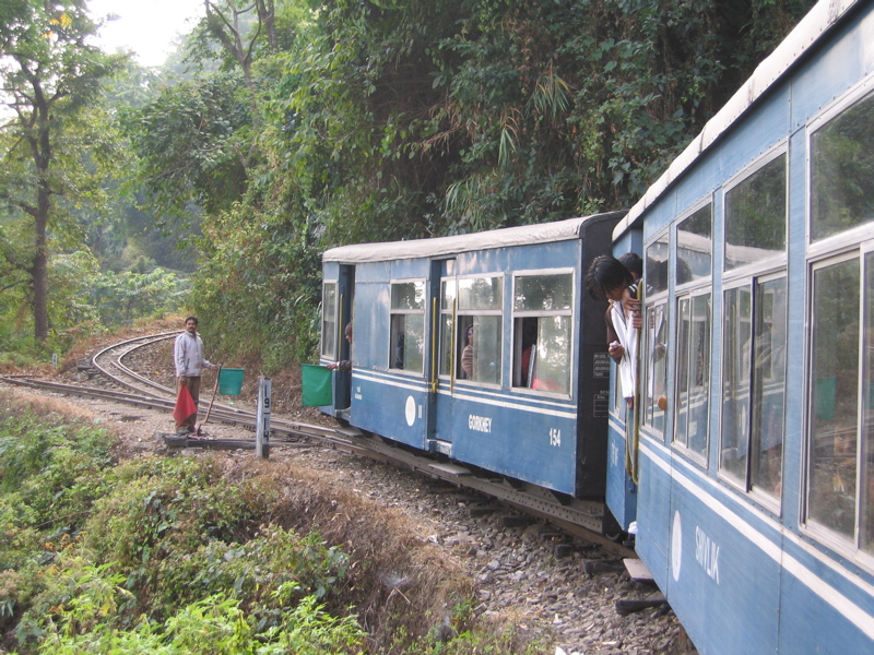
The train is named Darjeeling Himalayan Railway, nicknamed "Toy Train". Nowadays, the train is run on diesel. And the four small passenger wagons (the first class only fits 12 people) are also of a newer date. But the track is still the historic one laid by the British (the contruction had started in 1879). It is a narrow-gauge (610 mm), that first has to climb from Darjeeling (2077 m) to 2258 m and then all the way down to the plain (Siliguri lies at 158 m). The train can hardly go faster than 15 km/h even on the way down. Thus, the whole trip took a full 7 hours! And that was only to Siliguri (the last station is at NJP, which makes for a total distance of 88 km). The train is sufficiently slow for locals to jump up and hitch a ride without having to pay a fare (a habit that is tolerated). At times it even goes in zigzag. It will drive into a dead-end. Then at the back a switch is turned and it goes in reverse for a while until it drives into another dead-end. Then a switch is turned in the front, and the train can continue in the normal way.
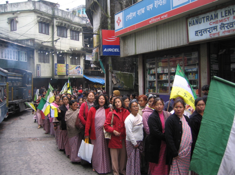
On the way we passed a demonstration by the GJMM women's wing, which calls for a separate state Gorkhaland. Originally, a general strike had been called for to press their demands. But as the government had agreed to talks, that strike had been called off. To compensate for that, the Jana Chetna called for a 24 hour bandh on Monday in order to express their opposition to the talks (supposedly with moral support of organizations like Aamra Bangali, Shiv Sena and Janas Jagaran). This turned out to put me into trouble. No cars or buses were running from Siliguri to the airport. But at the hotel where I stayed they found a motorbike driver who took me to the airport (the price was such that it made it worth the risk for him). That was a bit of an adventure. But in the end we got through fine. It also helped that we were right behind an army truck when we passed the strike-lines.
And after a long time at Bagdogra and then Kolkata airport I finally arrived in Bangalore.