Not only does Provence offer beautiful cities and villages, but Provence also has a very special landscape. And the best way to get to know this landscape is trekking. So for this trip to Provence, trekking was the focus. A description of the treks is also available in
![]()
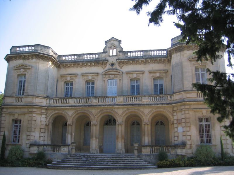
The base was Avignon, as it is located very centrally in Provence. From there we mostly needed less than one hour and thirty minutes to reach the starting points of the treks. Plus Avignon is also a beautiful city that offers nice strolling in the evening. The second part of September is a good time for trekking there. In summer it can be extremely hot. And because of the fire hazard many trails are completely closed or open only in the morning. But these restrictions no longer applied when we went hiking.
It is not possible to do trekking without a good description of the treks. Our treks followed the descriptions in two books.
Here is an overview of the treks that we undertook. The table lists the trek numbers of the respective books. The distances and times are from the books, as they are fairly realistic.
| # | Name | # from trekking guide | Distance | Time | Climb |
|---|---|---|---|---|---|
| 1 | The gorge of Font Jouvale and Falaise de Lioux | # 14 + # 13 from "Genusswandern Provence" | 15 km | 4:15 | 535 m |
| 2 | From Vauvenargues to Croix de Provence | # 32 from "Genusswandern Provence" | 18 km | 7:30 | 850 m |
| 3 | From Maussane-les-Alpilles to the medieval Les Baux | # 22 from "Wandern in der Provence" | 12 km | 4:00 | 250 m |
| 4 | The Calanques of Cassis | Part of # 27 from "Wandern in der Provence" | 10 km | 3:00 | 200 m |
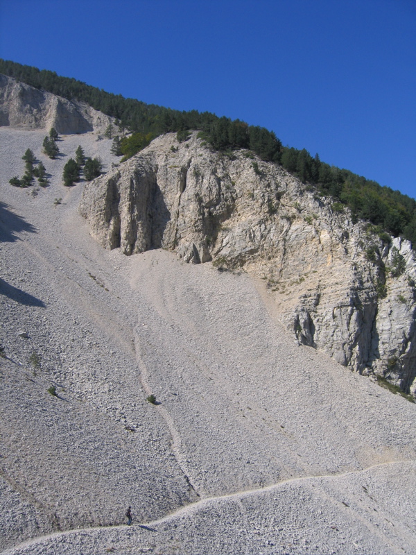
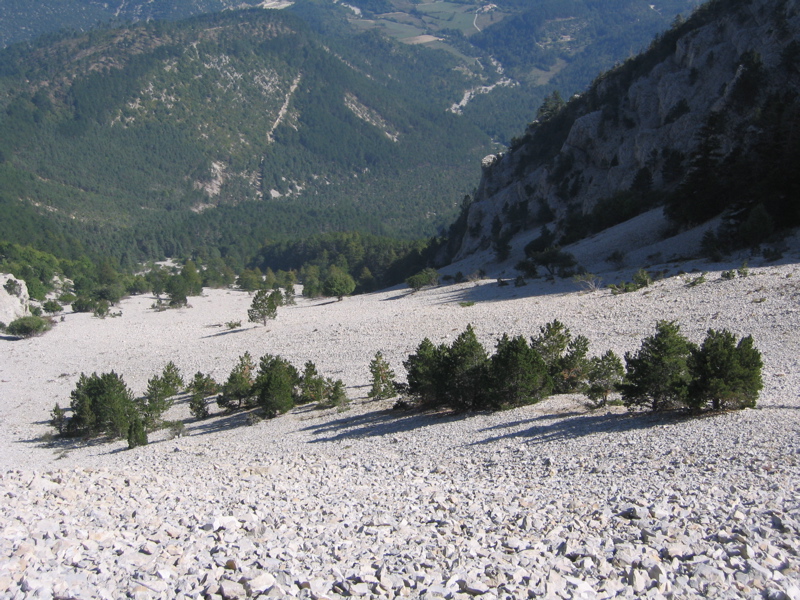
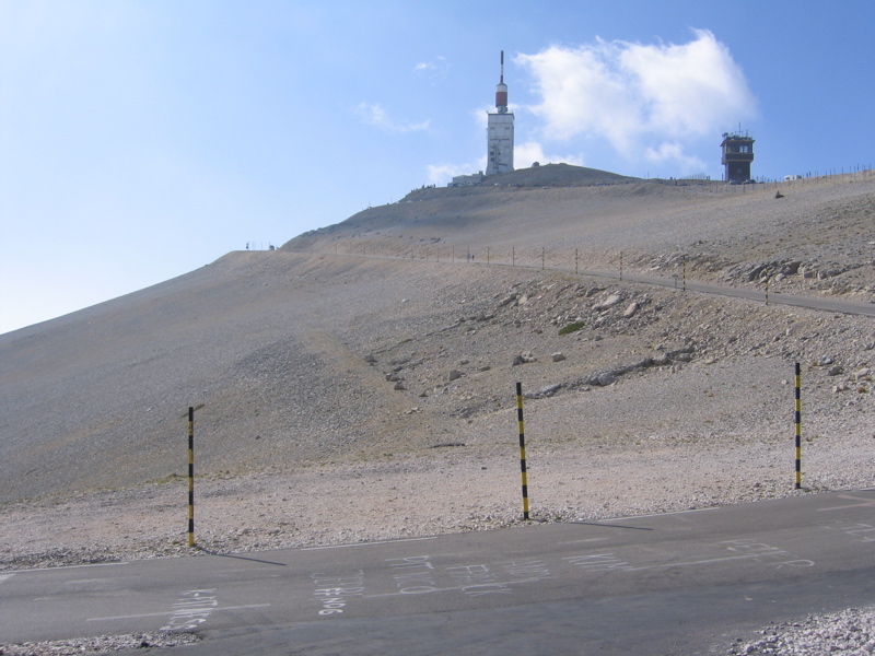
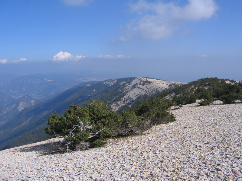
| 5 | Through the northern side of Mont Ventoux | # 6 from "Genusswandern Provence" | 16 km | 6:15 | 740 m |
| 6 | To Daudets mill | Part of # 31 from "Genusswandern Provence" | 3 km | 1:00 | Flat |
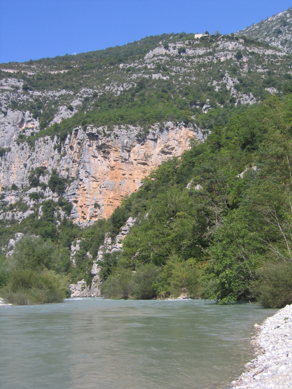
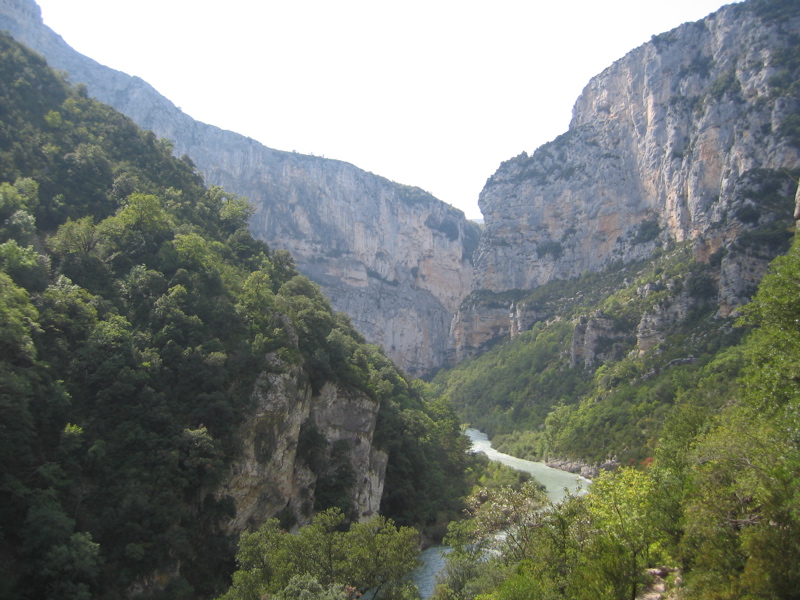
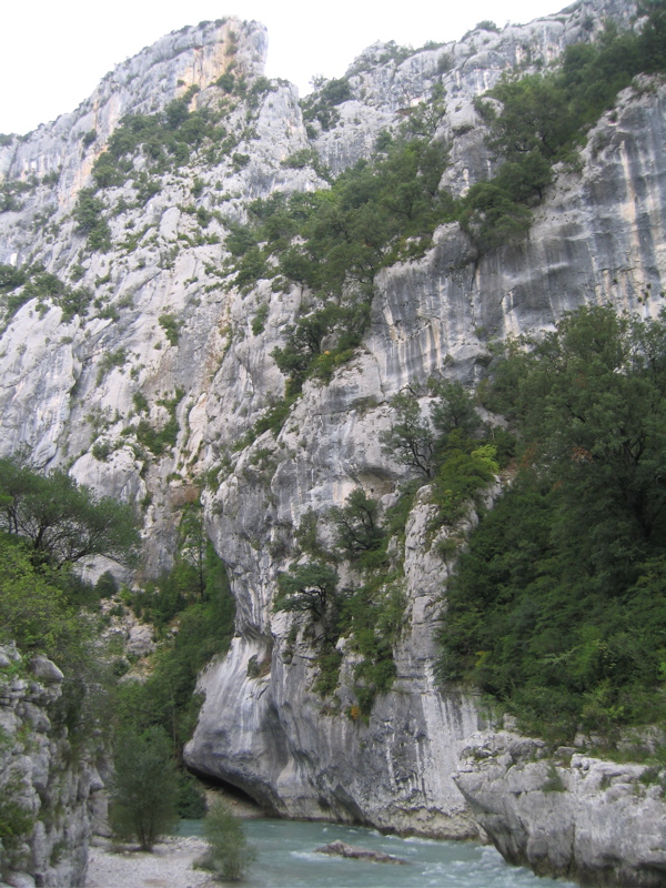
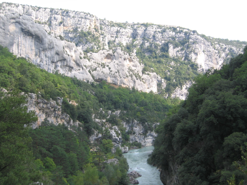
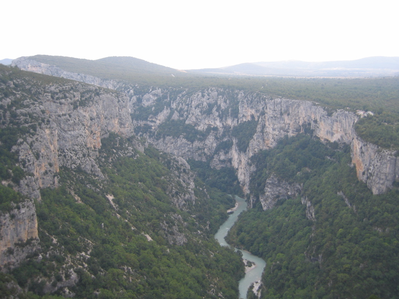
| 7 | On the Sentier Martel through the gorge of the Verdon | # 33 from "Wandern in der Provence" up to the Mescla and back | 13 km | 5:30 | 400 m |
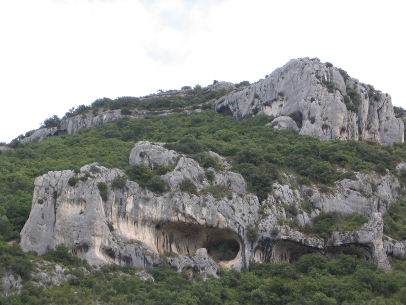
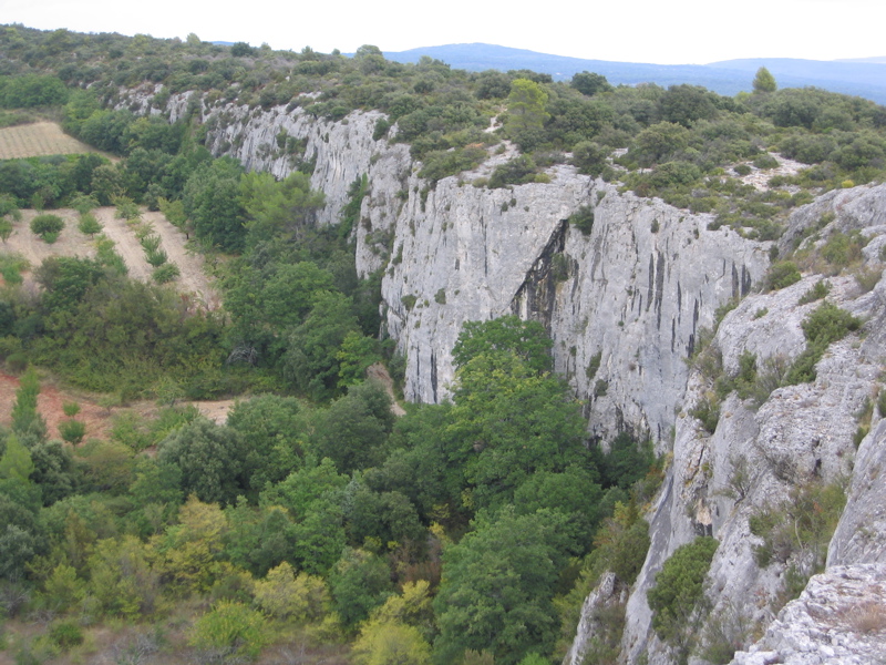
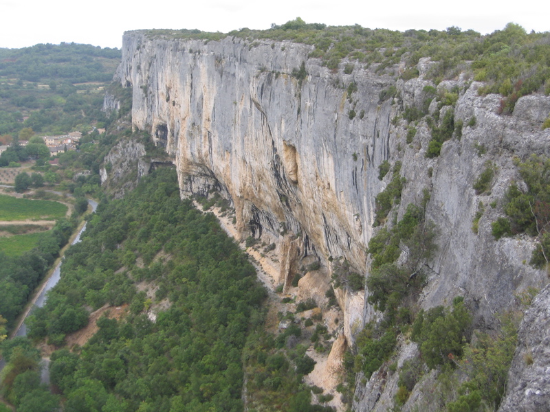
These are really two separate treks. Start for both is the Ste-Madeleine Chapelle above Le Château. Initially, the trail goes North up a hill and down again to the northern entrance of Combe de Font Jouvale. We went back through this gorge. Particularly pretty are the caves that were inhabited by people in pre-historic times. After we left the gorge, we could see the red-colored rocks near Roussillon. The second trek went up the hill in north-western direction until we reached the upper end of Falaise de la Madeleine. We followed this wall on top down South. Where it ended we changed back towards the car.
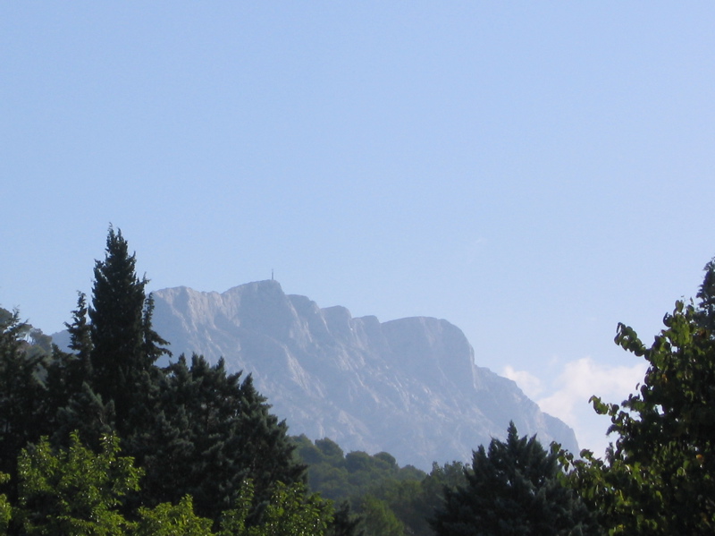
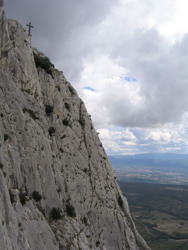
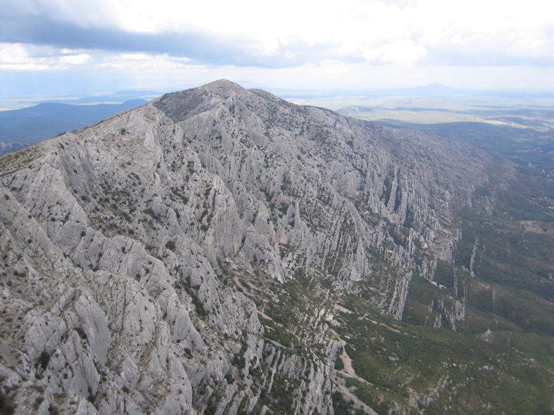
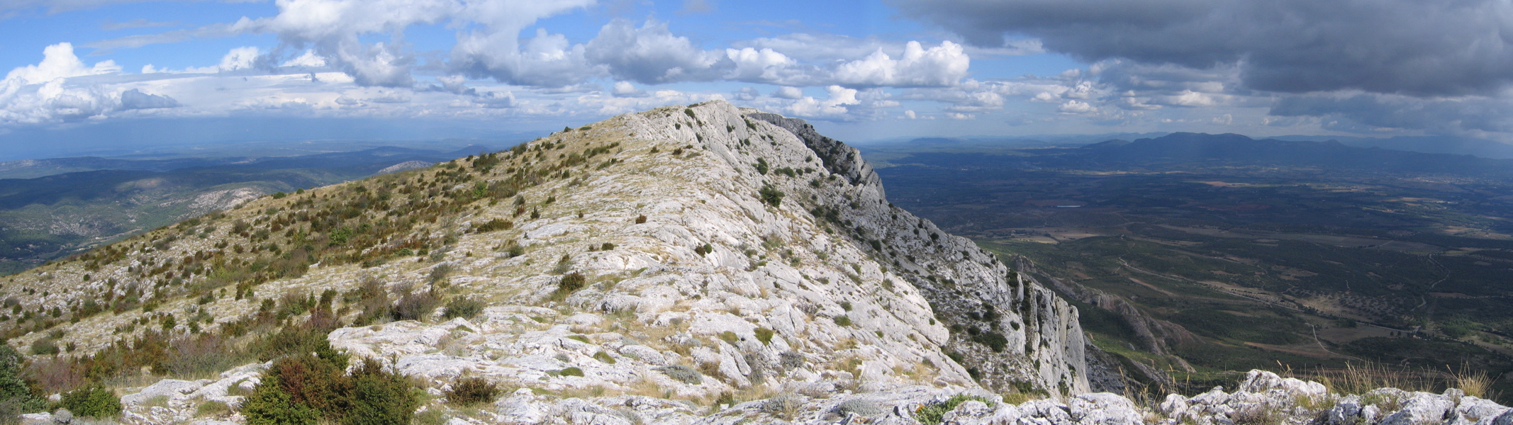
The trek began at the castle of Vauvenargues, which was painted by Paul Cezanne several times and which was later bought by Pablo Picasso. After crossing a ridge, the trail first continued West along a flat valley. Then it climbed steeply up to the Croix de Provence. On tip it followed East along the edge of the Sainte Victoire with some spectacular views. After a good hour we reached the spot where the trail went down steeply.
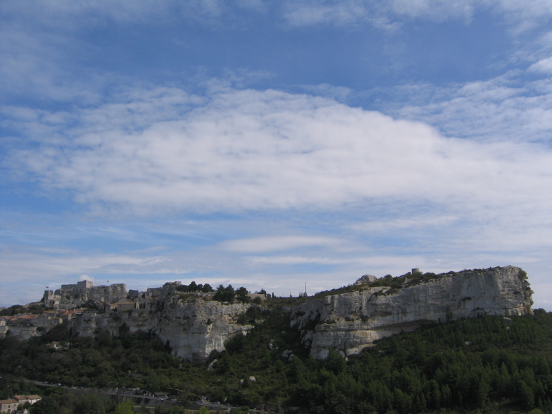
Starting in Maussane-les-Alpilles we first went North towards the limestone rocks. Through a gap we got into a basin with many olive trees. Below Les Baux we reached Chapelle des Trémaïé. Continuing past it, the trail went around the rock on which Les Baux is built, and we entered the village. The many tourists were rather bothersome, so that we did not stay long. Instead we crosed the valley and hiked up the opposite limestone rocks, from which one has a nice view of Les Baux. After a long northern curve we came back to Les Baux. With some small variations compared to the initial trail we arrived again in Maussane-les-Alpilles.

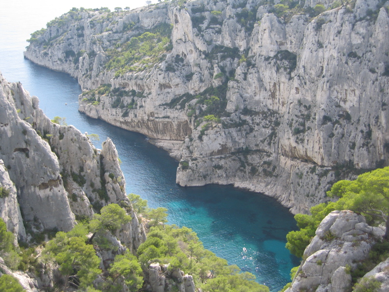
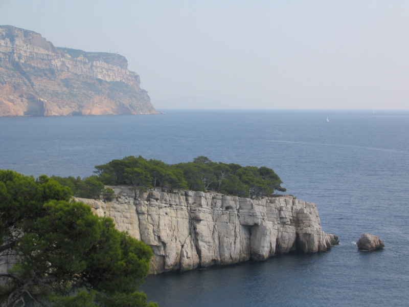
This trek started from Cassis and first went through a light forest to Calanque d'En Vau. From there the trail continued above the sea first following the Calanque de Port-Pin before ending at the Calanque de Port-Miou.
First we drove with the car along the classic track of the Tour de France up to the Chalet Reynard at 1400 meters. Here the trail started, initially upwards, before descending a bit the northern side at the Tête de la Grave. There the trail continued fairly evenly with many spectacular views and occasionally quite exposed. Finally the trail went up in serpentines to the trop at 1912 meters. The trail down followed less spectacularly down the ridge.
This was a relaxed stroll from Fontvieille past Château de Montauban to Daudets mill. Here the writer Alphonse Daudet wrote the "Letters from my mill" in 1866. After a picnic in the forrest we went back.

Starting at Chalet de la Maline the trail went down steeply in serpentines to the Verdon. There it went up and down following the Verdon towards its origin. There were many spectacular views, and the trail was quite exposed a number of times. Nevertheless, there were several opportunities to go all the way down to the bank of the Verdon especially at the beginning. At the Mescla the Artuby flows into the Verdon. This was the location from where we turned around and went back the same way that we had come.